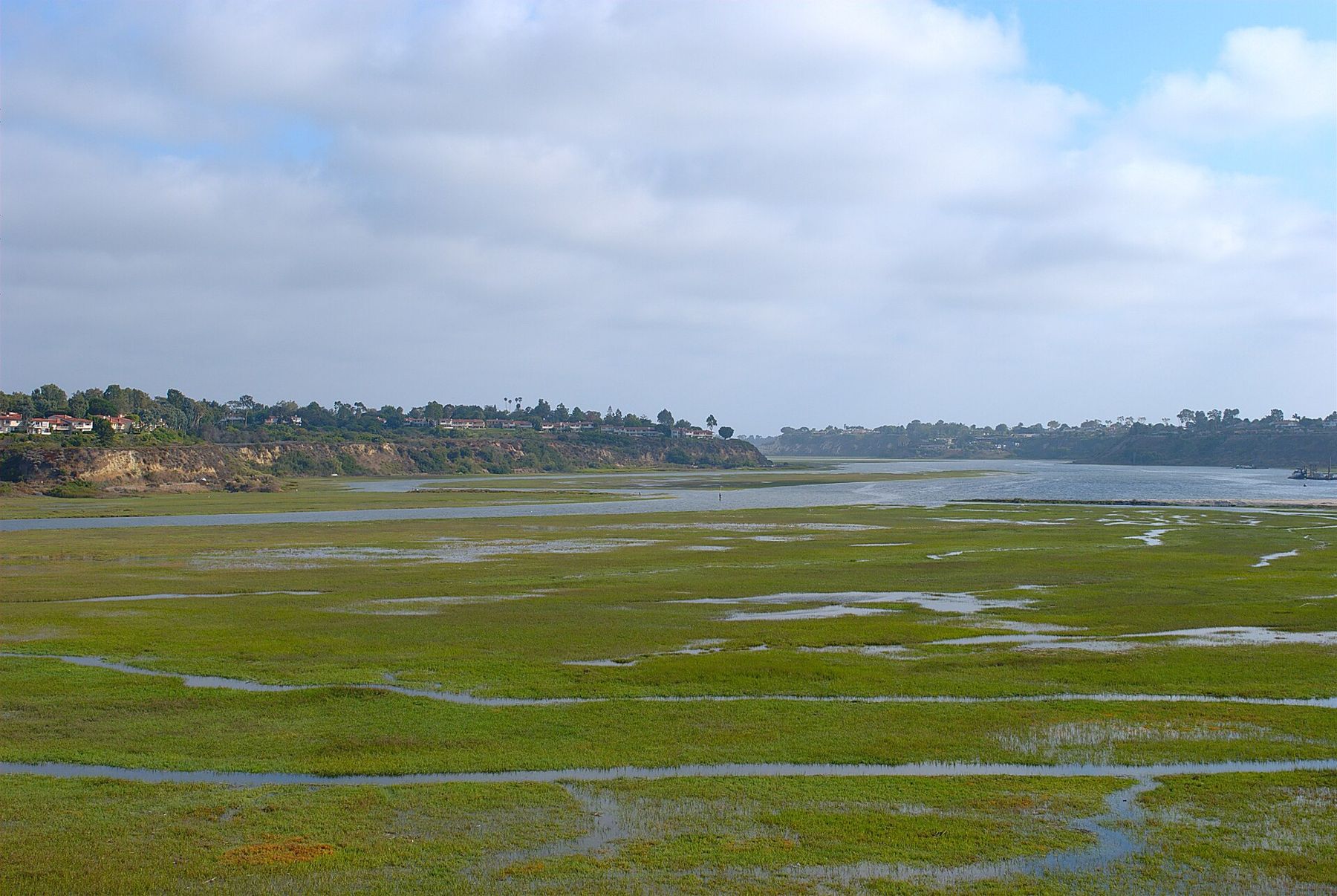
Look out of the window as you take off from John Wayne Airport (SNA) heading south and the first thing below you is a wide, winding stretch of water and green marsh. That is Upper Newport Bay, usually called the Back Bay, and it is one of the largest remaining coastal estuaries in Southern California. For a traveller with a few spare hours, it is also the closest real landscape to the terminal: no beach crowds, no shopping streets, just tidal channels, bluffs and a great many birds.
The bay is protected as a state ecological reserve, with a county nature preserve on the surrounding bluffs. Paths and a quiet road run along its edges, so you can see a good part of it on foot in an hour or two, or ride most of the loop on a bike.
What the Back Bay is
Upper Newport Bay is the inland arm of Newport Harbor. Fresh water arrives from San Diego Creek and smaller channels at the northern end; salt water pushes in from the ocean through the harbour twice a day. The meeting of the two makes the brackish marsh, mudflats and open water that you see from the bluffs.
Development surrounds it on almost every side, which is what makes it so striking: houses line the top of the bluffs, yet the floor of the bay is a broad, flat world of pickleweed, cordgrass and shining channels. The reserve shelters several sensitive species, among them the Ridgway's rail, a secretive marsh bird that is rarely seen but sometimes heard clattering from the reeds.
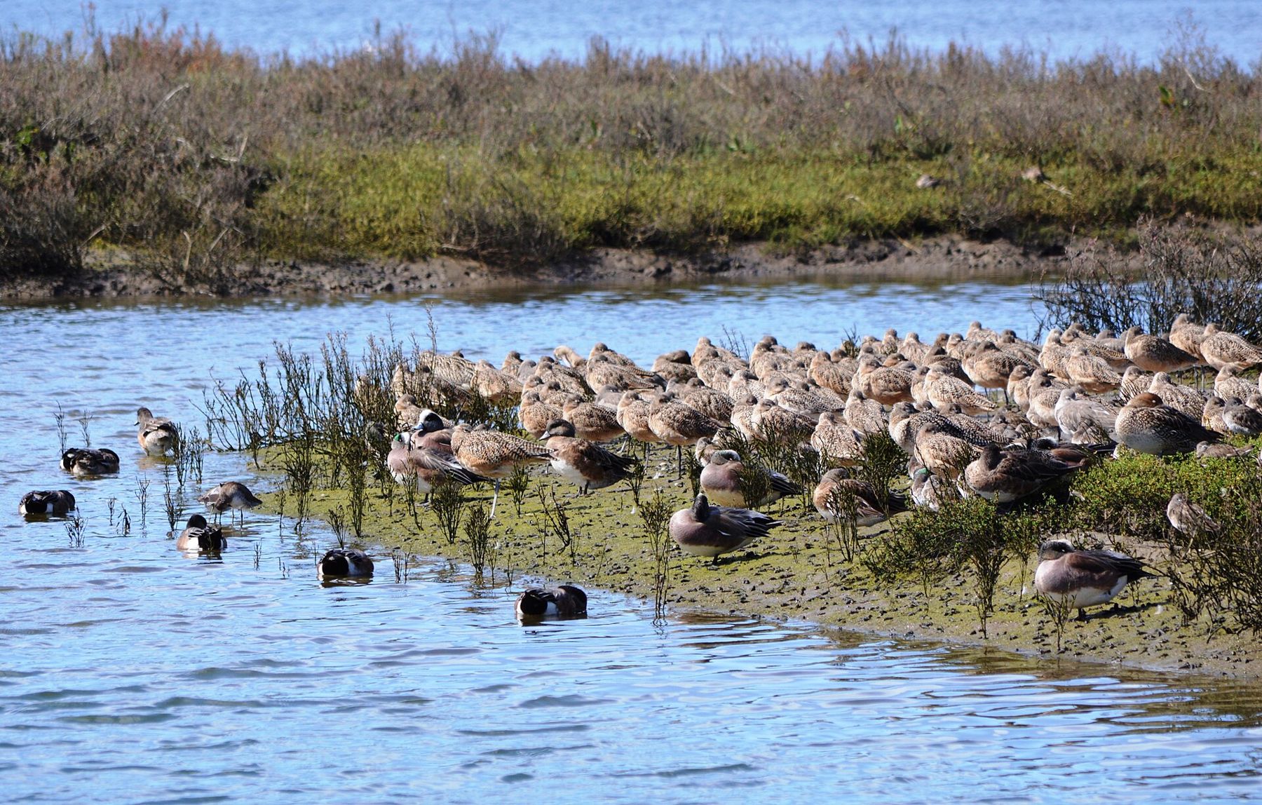
Winter is the busy season. From roughly autumn to early spring, migrating ducks and shorebirds stop here in large numbers: godwits, willets, avocets, wigeons, pintails and many more. Great blue herons, great egrets and snowy egrets stalk the shallows all year.
Walking and cycling the loop
There are two simple ways to see the bay with limited time.
On foot
The easiest start is the area around the Peter and Mary Muth Interpretive Center, a nature center built into the bluff on the west side of the bay. Trails lead from the bluff top down towards the water, and the views across the marsh are wide even if you only walk for half an hour. Opening days and hours for the center change, so check before you go; the outdoor trails and viewpoints are the main draw anyway.
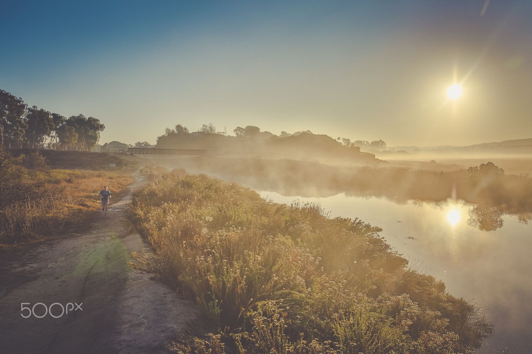
On the east side, Back Bay Drive runs along the water's edge beneath the bluffs. Much of it is shared by walkers, runners, cyclists and a limited amount of slow car traffic. It is flat, close to the marsh and good for birds at almost any tide.
By bike
A full loop around the bay, using the bluff-top paths and Back Bay Drive, is roughly ten miles, with a couple of short climbs from water level to the top of the bluffs. On a bike that is an easy ride of an hour or so plus stops. Bike paths also link the area with the Santa Ana River trail system and the rest of Newport Beach, so if you are comfortable in traffic you can extend it. Getting a bike and carrying bags are covered in the guide to buses, bikes and what to do with your bags.
If you cannot find a bike, do not try to walk the full loop on a tight layover. Pick one side, walk out and walk back.
When to go: tides, light and mist
Timing makes a large difference here. At high tide much of the bay is open water and the birds gather in fewer, more distant places. As the tide falls, the mudflats appear and the shorebirds spread out to feed, often close to the paths along Back Bay Drive. A falling or low tide in the morning is usually the best combination. Tide tables are easy to find; check them before you set out.
Mornings often begin with a soft mist over the water, especially in late spring and early summer when the marine layer sits over the coast. It burns off by late morning on most days. The guide to June gloom, Santa Anas and the best hour of light explains the pattern in more detail.
Late afternoon brings warm side light across the bluffs and a second wave of bird activity. In summer the bay is quieter for birds, but still green and pleasant, and less crowded than the beaches.
A falling or low tide in the morning is usually the best combination.
Getting there and getting back
The north end of Upper Newport Bay is only a few miles from the terminal, and in light traffic a taxi or rideshare takes about ten minutes. Pickup zones at the airport are signed; the logistics are covered in leaving the terminal. Parking near the interpretive center and along the bluff top is limited, and rules and hours vary by lot, so check signs on arrival.
Public buses run along nearby main roads, but connections take time and are not a good choice for a short layover.
Getting back is the part that needs care. Distances are small, but the roads around the airport fill quickly at rush hour, and the walk back up from the water to a pickup point can take longer than you expect. Leave the bay with at least two and a half hours before your departure, more for an international flight or if you need to check a bag, and confirm your airline's own advice for arrival time.
Respecting the reserve
Because this is an ecological reserve, the rules are stricter than in a city park. Stay on the marked paths, keep dogs leashed where they are allowed, and do not walk out onto the mudflats or into the marsh vegetation: nesting and feeding birds are easily disturbed, and the mud is soft and deep. Fishing, boating and collecting are regulated in parts of the reserve; read the posted signs.
Bring water and sun protection. There is very little shade on the trails, and even a mild-looking day can feel hot on the bluffs at midday. Restrooms are few and far between.
Making the most of three hours
A realistic plan for a layover of five or six hours, with three hours or so outside the terminal, looks like this:
- Taxi or rideshare from the terminal to the bluff top near the interpretive center.
- Walk the bluff paths and down towards the water for an hour, binoculars out.
- Head back to a pickup point with plenty of time, and return to the terminal with a generous buffer for security.
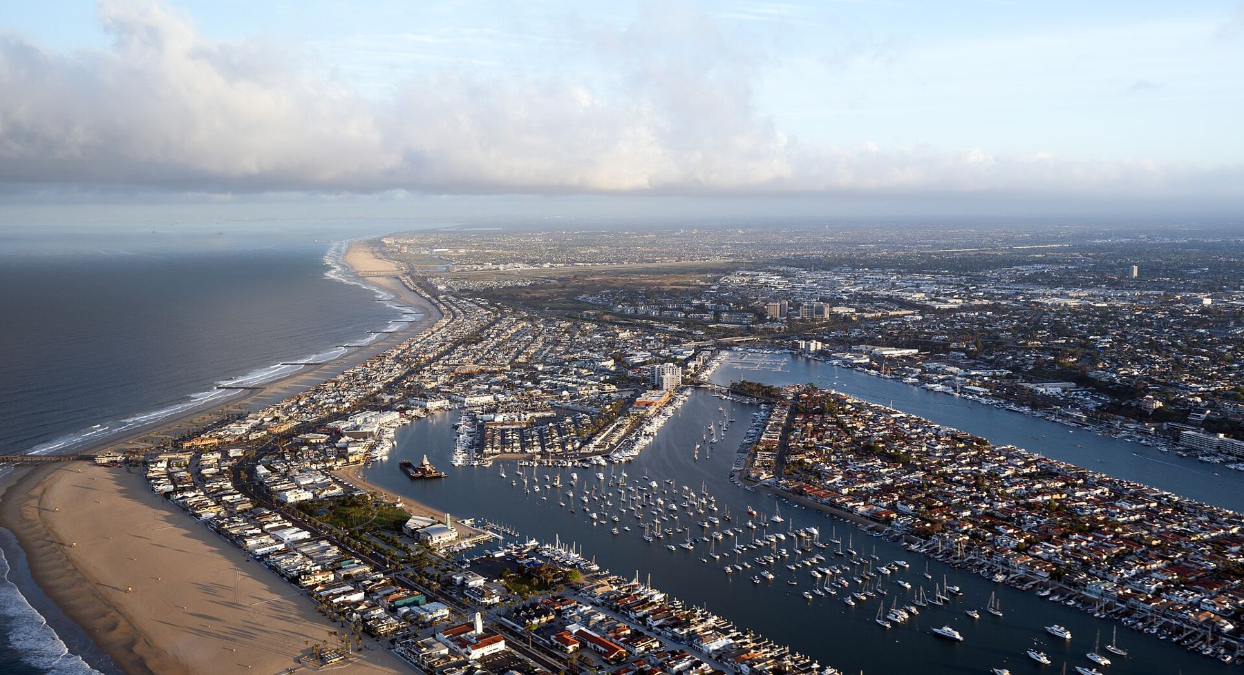
If you have longer, the bay connects naturally with the lower harbour. The Back Bay drains into Newport Harbor, and a short ride south takes you to the Balboa Peninsula and its small car ferry. Combining the two is possible on a half day, but the beach areas are busier and traffic is slower, so add time.
Above all, keep your buffer generous. The bay is close to the runway, which makes it tempting to stay one more half hour. Watch the clock rather than the planes overhead, and leave while you still have time to spare.